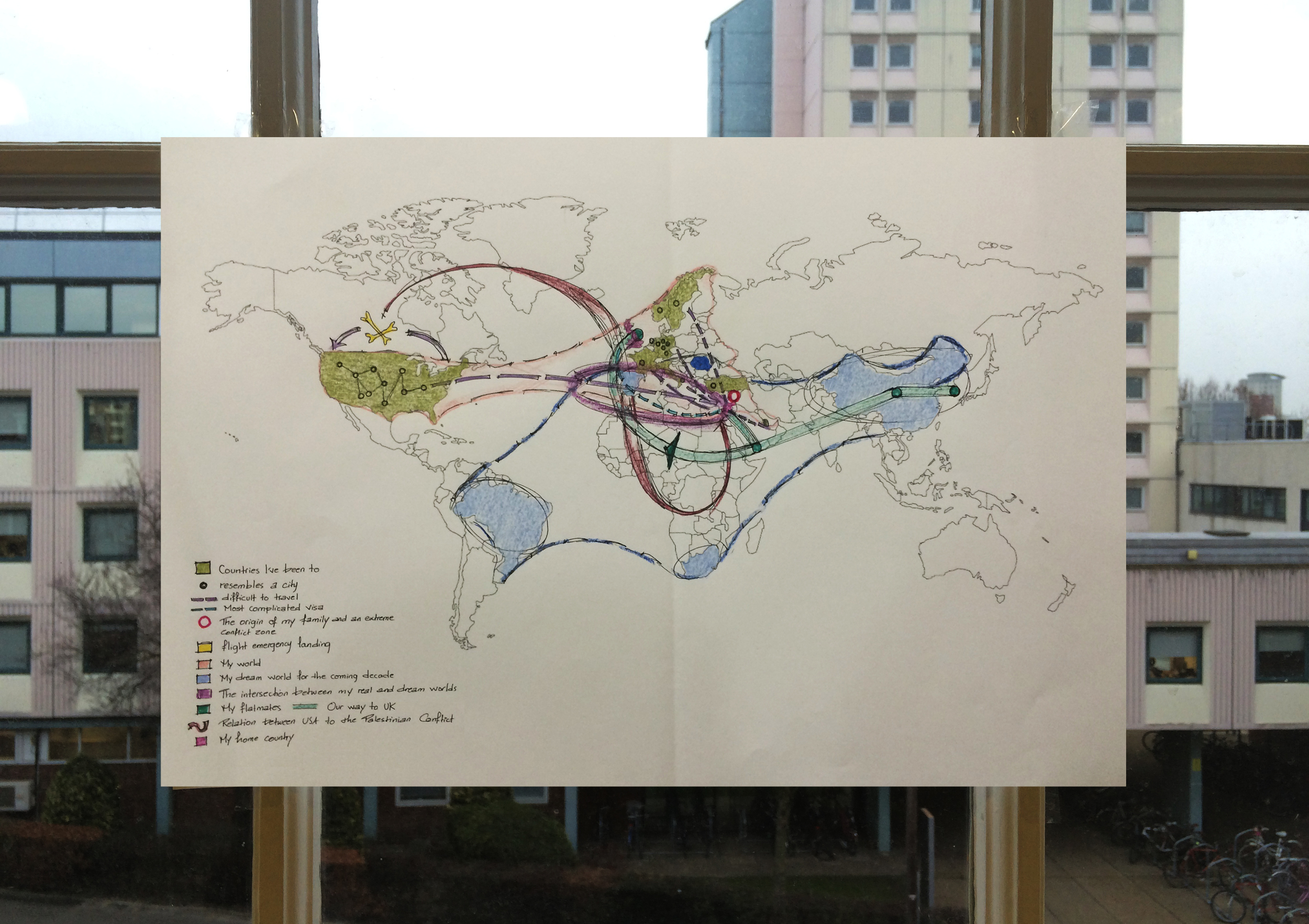
“Uncultivated state land therefore existed in widely different scales, from large tracts of desert, to other smaller islands of rocky land, punctuating and puncturing the private fields of farmers. The borders between cultivated and uncultivated lands often followed a clear topographical logic. The mountain range of the West Bank is corrugated by a repeating sequence of winkles and folds. The agriculturally suitable alluvial soils erode down from the summits to the slopes and the valleys. These summits are thus rocky windswept, while the slopes and valleys are fertile and cultivated with orchards and arable crops.” Weizman, 2007.
In order to understand, how can tools and softwares that produce maps play a role in defining the different scales of state land. I made an experiment using the “tolerance” tool in photoshop, in which I based the differentiation between cultivated and uncultivated lands on a differentiation between colors, green and brown. I then played with different tolerance values to produce different maps of Susya, in which the white is the Palestinian cultivated land, and the color is Israeli state land. The different results show how manipulative this can be on the ground. Although, I don’t claim that this is an accurate way to think the political conflict at stake, but it does in fact provoke questions about what defines a cultivated land, and to what extent of division can Israel refer when declaring state lands, can a piece of rock become Israeli for example?